2023 update of global boundaries data: Improving accuracy for businesses worldwide

Breaking News:
Kathmandu Nepal
Samstag, März 22, 2025

The 2023 release of our updated global boundaries data is a significant advancement for companies with a global footprint. By using this data, companies can gain a better awareness of their markets and use that knowledge to make more informed decisions about how to develop and manage their operations.
Data on global boundaries is essential for businesses to successfully expand and grow. By having access to accurate data about the countries and regions in which they operate, businesses are able to make data-based decisions and optimize their operations. This can include being able to identify key markets and potential customers, as well as determining the best locations for their operations. With the release of the 2023 update of our global boundaries, businesses will be able to keep up-to-date on changes in their countries and regions of operation, ensuring that their decisions are based on the most recent information. By having access to accurate, current data on global boundaries, companies can remain agile and adapt to changes in the global market.
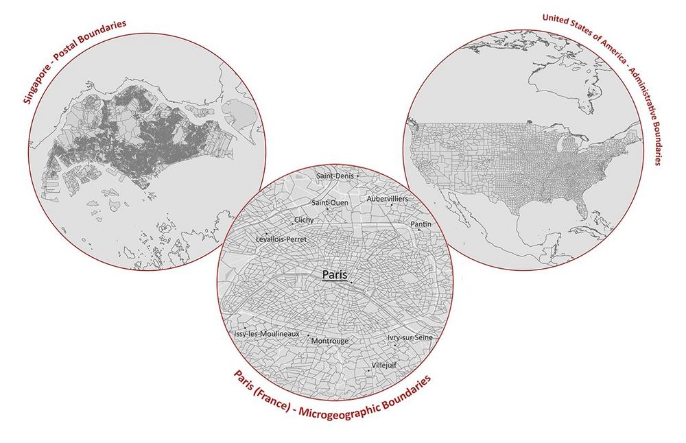
Our comprehensive global boundary dataset comprises digital maps based on vectors, covering administrative, postal, and microgeographic details for more than 248 countries and over 1,000 geographical levels.
Discover what’s new: Updates to our global boundary datasets
We now offer the latest version of territorial status with updated boundaries. Apart from updated layers, we have also expanded our inventory of diverse layers.
As of now, we provide updated global boundaries for the following countries, which includes new additions and recent updates:
In addition, we have also further improved levels for the following countries:
Furthermore, we added "city points" for cities with populations exceeding 50,000 in 2022. Additionally, we now provide city names in both English and the respective national language.
Unlocking new opportunities: Harnessing the advantages of our comprehensive global boundaries
MBI’s global boundaries are renowned for their high data standards and accuracy. All layers are topologically correct and precise, as well as seamless to the boundaries of neighboring states. Additionally, the global boundaries can be easily combined with data and areas from several countries. This is made possible through a unique key that facilitates transnational analyses, allowing customers to combine data from different countries into a single layer. This is particularly useful for those working with market data, as it allows for easy integration and analysis.
In addition to their compatibility, MBI offers one of the most extensive inventories of global boundaries available, including administrative, postal, and micro levels. Furthermore, all layers are updated with strict quality control at regular intervals to ensure they remain up-to-date and accurate.
It’s easy to integrate our global boundaries thanks to their provision in all standard GIS formats, including ESRI-Shapefile (.shp), GeoDataBase (.gdb), MapInfo TAB Extended (*.tab), GeoJSON (*.geojson), and GeoPackage (*.gpkg). Additional formats are available upon request. The vector-based format allows for performance editing at any zoom level, giving customers complete control over the data.
Overall, our global boundaries offer unparalleled accuracy, compatibility, and flexibility, making them the ideal choice for businesses looking to take their data analysis to the next level. For more information, please contact our Sales Team.
Being a specialist for small-scale data for Geomarketing, Michael Bauer International has grown to one of the largest global data providers for over ten years. MBI unites passion and scientific know-how to provide globally consistent and comparable geographic data.
Today MBI is not only recognized as a key data source but is also the preferred data provider for the largest leading GIS software and technology companies globally. For a vast variety of companies, MBI’s data is the foundation for location-based questions related to company locations as well as branch and distribution networks. MBI mobile data offers valuable insights into the global consumer behavior and their customer journey. Companies from all industries are supplied with up-to-date data for market analyses and visualization by MBI, to take informed and data-based decisions.
With CONIAS Risk Intelligence, we provide in-depth and data-driven information about the current and emerging dynamics of political conflicts worldwide. We support internationally operating companies and organizations in identifying political risks to location, logistics and investment security at an early stage and in developing targeted adaptation strategies.
MBI is one of the first global HERE Technologies Distributors. HERE is the leading provider in the development of digital maps and location-based services.
Both Michael Bauer Research GmbH and Michael Bauer Micromarketing GmbH are part of the Michael Bauer Group.
For more information, please visit www.mbi-geodata.com.
Michael Bauer International GmbH
Greschbachstr. 12
76229 Karlsruhe
Telefon: +49 (721) 1618566
Telefax: +49 (721) 94540496
http://www.mbi-geodata.de
![]()